The Bay Area from 12,000 feet, May 20, 2001
I've gotten really into taking aerial photographs, and had
wanted to go way up and try to capture the entire peninsula
in a photo. I figured 12000 feet would be high enough to
accomplish this, and set out to take these photos.
I took a Cessna 152 because they fly fairly slowly and the
wings are over the cabin rather than under, allowing a clear
field of view to the ground. I knew it would take a while to
get up that high, especially in a 152. It turned out to take
almost an hour of climbing; I left Palo Alto Airport, made a
left turn at the Dumbarton bridge, and started climbing. When I hit
the coastline I took a left, and when I was over Monterey about
40 minutes later, I was still climbing at about 11,000 feet.
When I got to Monterey,
I turned around and
headed towards San Jose.
After passing over the bay and reaching a point north of
Sausalito, I began a gentle right turning descent to about
4000 feet and headed back down to Palo Alto, passing over
Concord, Walnut Creek, Livermore (off to the left a bit),
Sunol, then Palo Alto. The entire trip was a little more than
three hours.
These are all taken with Konica Autoreflex TC and Kodak film; One
day I will do this again (in a Cessna 172 :) and bring along a medium
format camera and see how things work out. Overall I am impressed
with the image quality considering the lack of special equipment.
Enough rambling; Onto the photos. Click on any photo for an
enlargement.
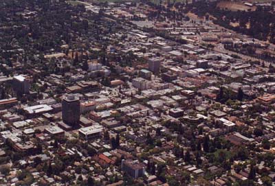 |
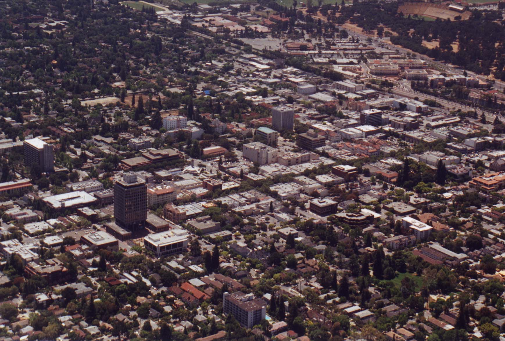
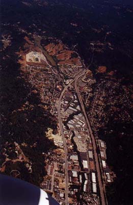
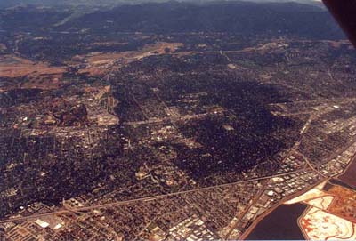
Downtown Palo Alto, seen just
after taking a left at the Dumbarton bridge. |
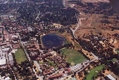
| Lake Lagunita on Stanford property
off of Foothill Expwy (or it's extension if it has
a different name). It used to be a neat sort of
beach place, but it is not anymore. |
 |
 |
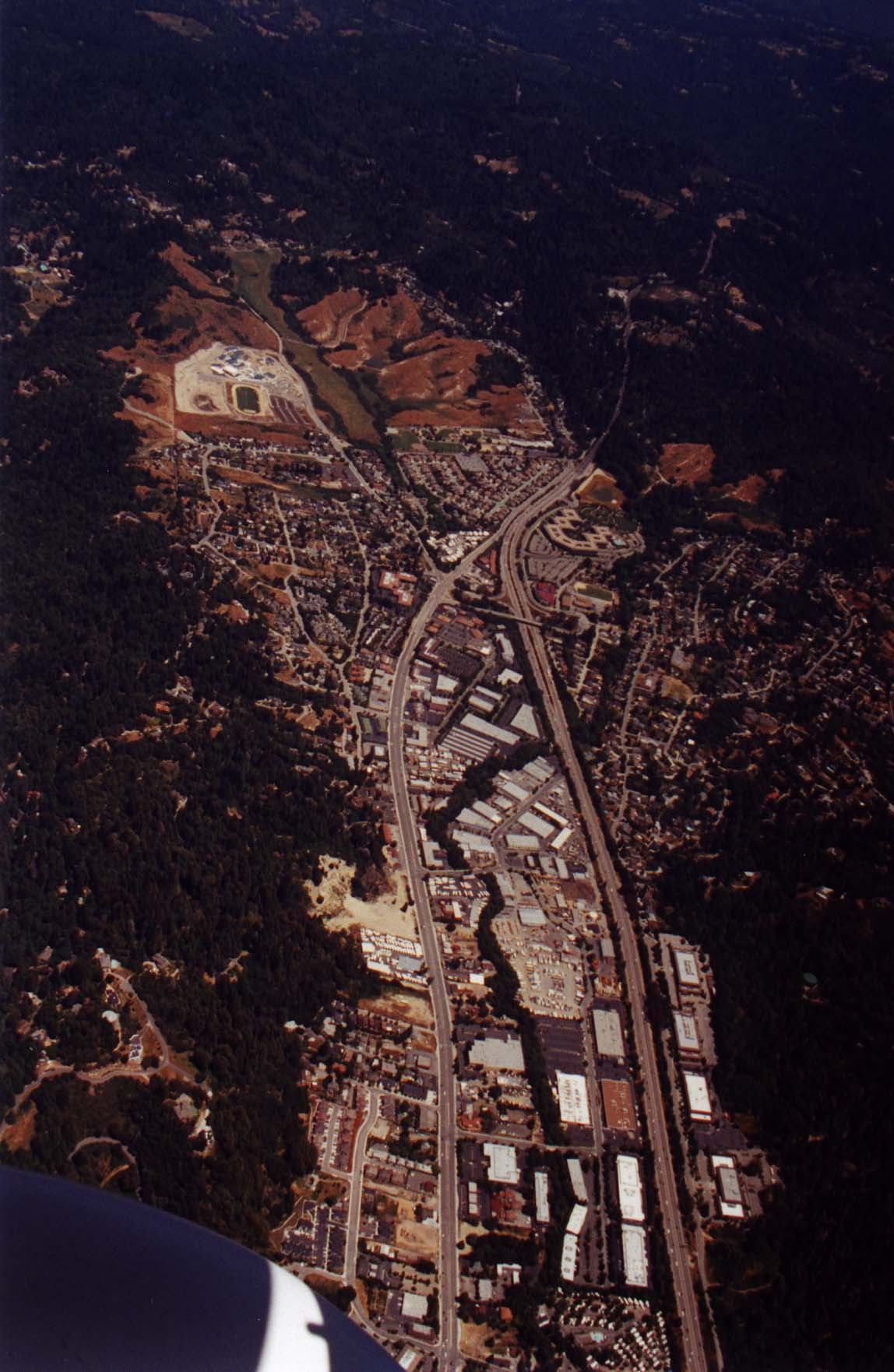
Scotts Valley, on Highway 17 before reaching
Santa Cruz. |
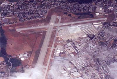
| The Watsonville Airport with partial cloud
cover. Watsonville is about 25 mins south of Santa
Cruz on Highway 1. |
 |
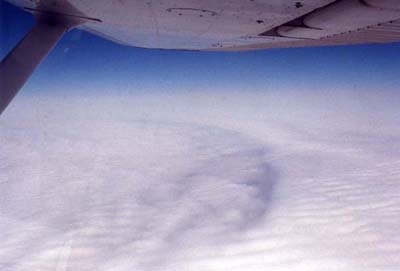 |
The view out the right window as I
climbed over Monterey bay at about 8000 feet. In many
ways this is one of the coolest pictures I took that day. |
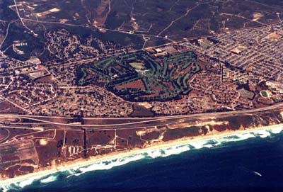
| A golf course off Highway 1 north of Monterey. |
 |
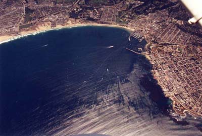 |
Monterey harbor, located at the south end of
Monterey bay. |
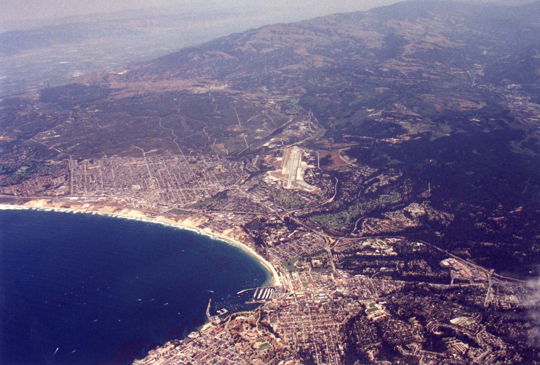
| The Monterey Airport from over Pacific Grove.
The harbor can be seen in the lower center of the picture. |
 |
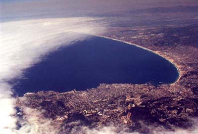 |
A view from over Carmel looking North at the
southern end of Monterey Bay. The cloud cover was very cool
on this particular day. |
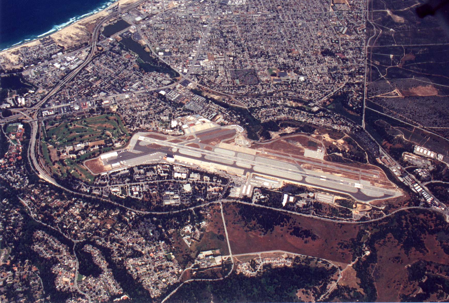
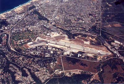
| Directly over the Monterey Airport. I was at
11,100 feet at this point and still climbing. |
 |
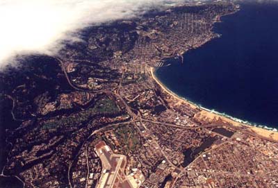 |
A little East of Monterey airport looking West
at the harbor and Pacific Grove. |
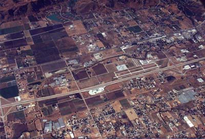
| South County airport next to Highway 101, south
of Gilroy. I don't know why, but I like taking pictures of
airports. North is to the right in this picture. I am now
at 12,000 feet, and for the remainder of the trip, vary between
about 12,000 to about 12,200 feet. |
 |
 |
This is a picture of where 101 goes from three
lanes to two; the bridge over the freeway in the right center of
the picture is the exact location. As can be expected, traffic
was backed up on this day like usual. |
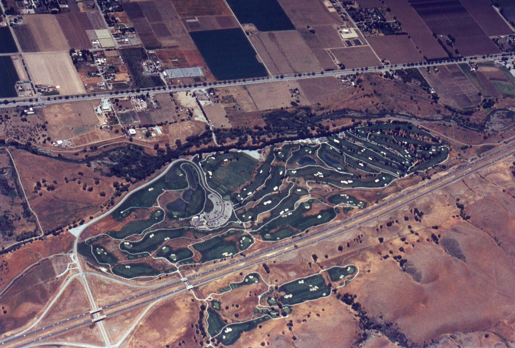
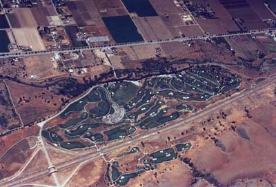
| Riverside golf course. (I think that's it's name) |
 |
 |
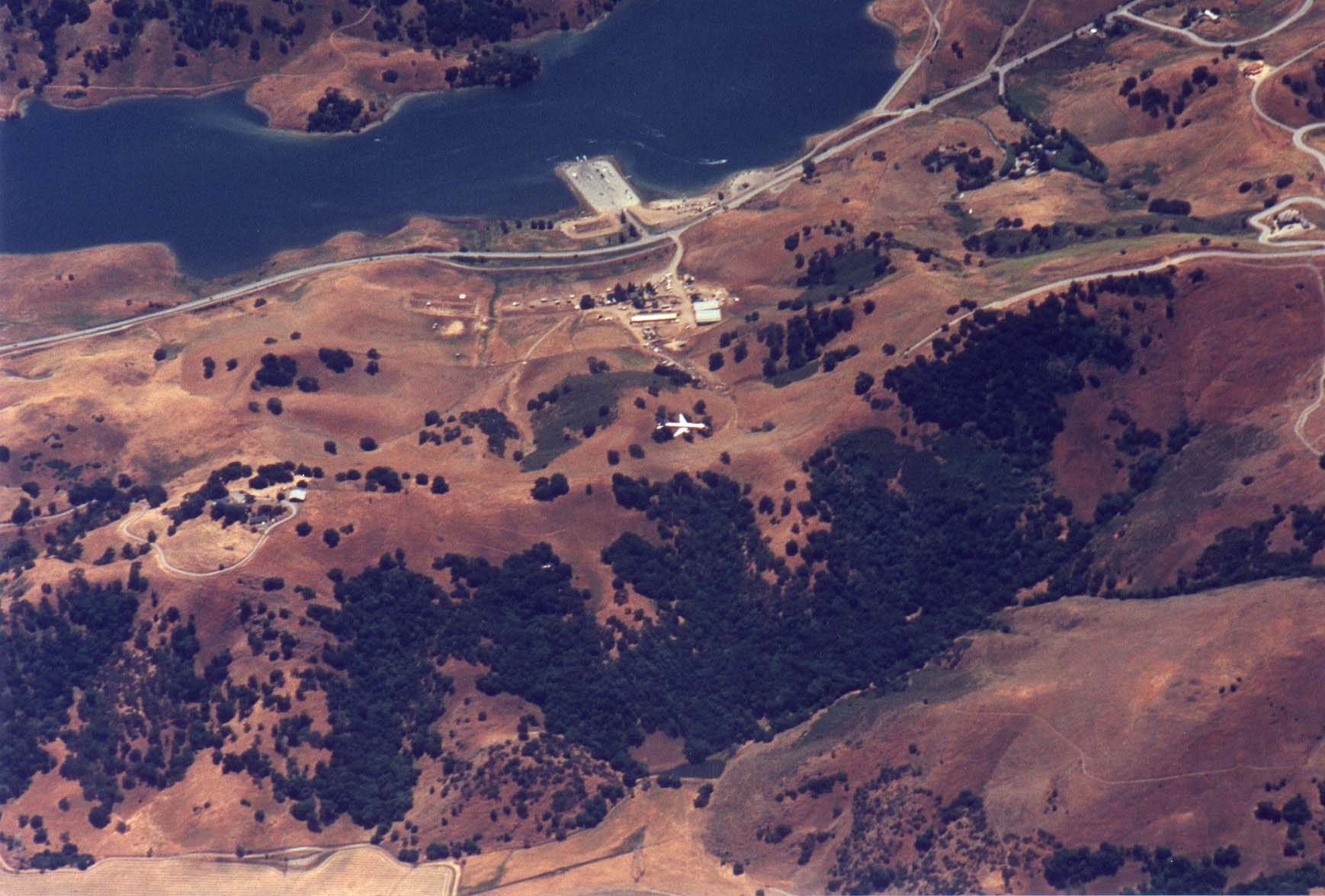
My first realization of how high I actually
was. This 737 below me is on approach to San Jose International at
about 6000 feet. |
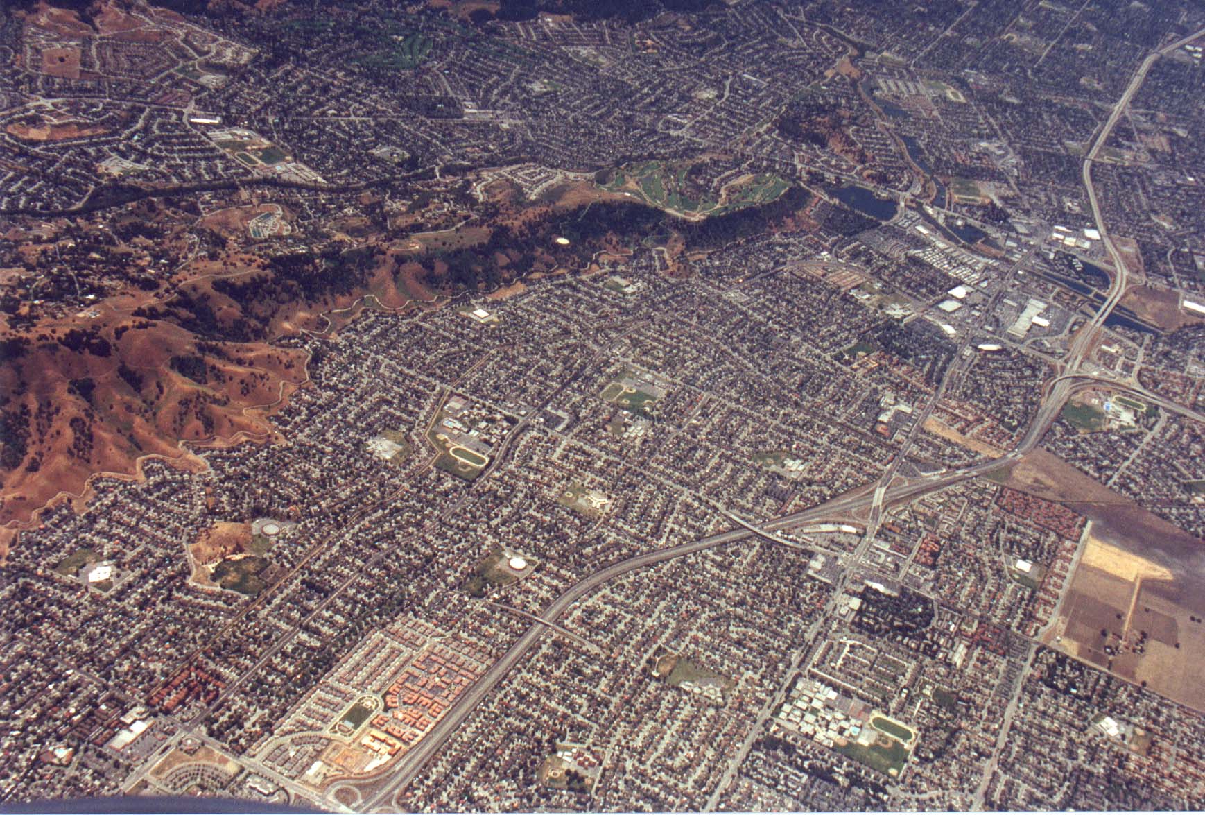
| The mass of houses in South San Jose begins... The
freeway going through the picture is highway 85 just North of where
it intersects 101. |
 |
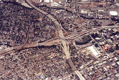 |
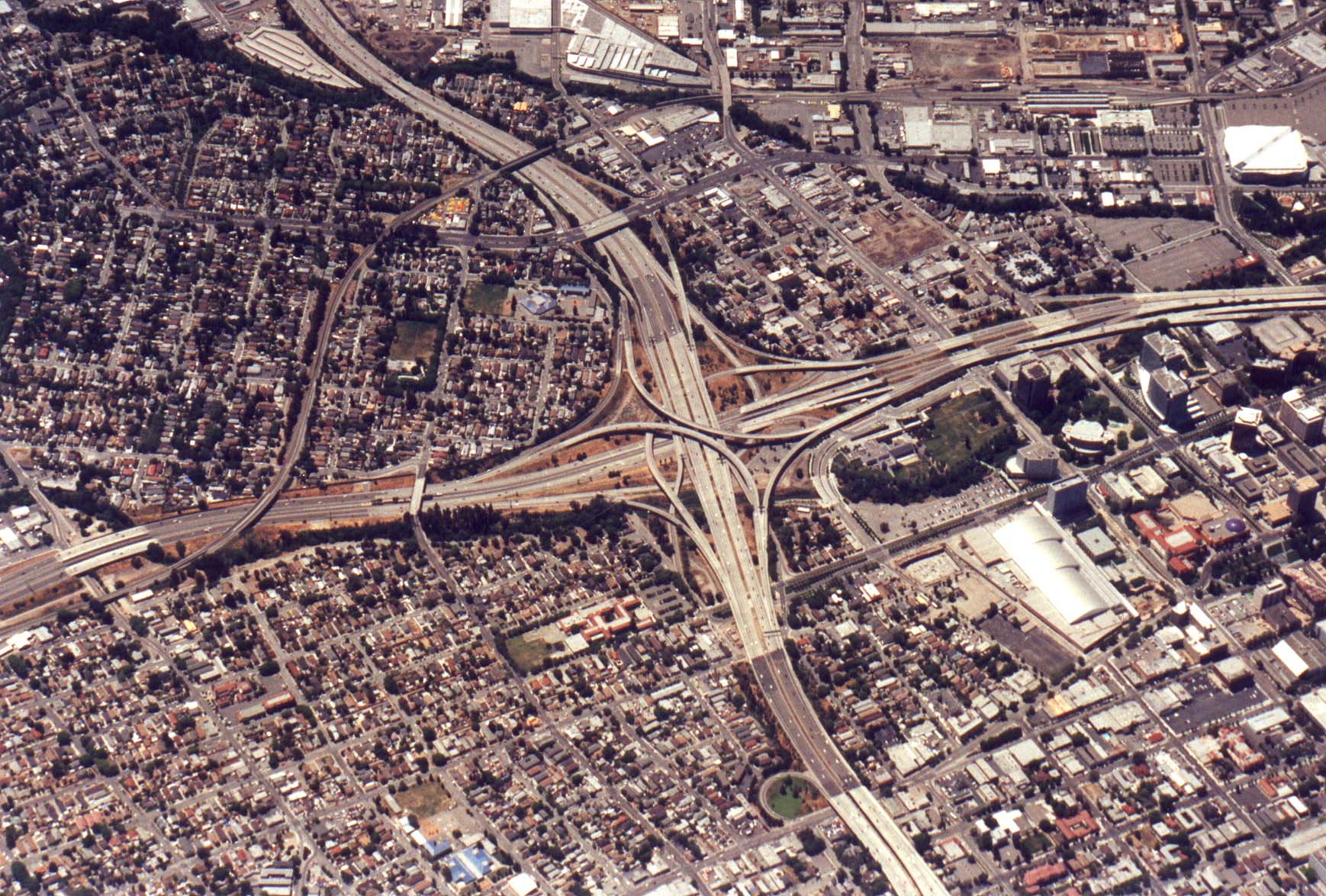
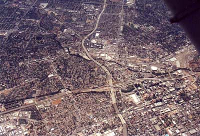
The intersection of Highway 280 and Guadalupe
parkway, a.k.a. Highway 87. |
| A wider angle view of the same intersection. The
brown patch of open land at the right of the picture is the
start of San Jose International. |
 |
(at this point I got hung up on the radio for a bit and couldn't take
pictures, so we miss the rest of San Jose).
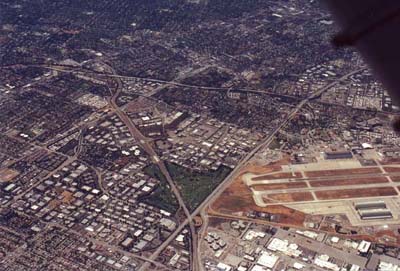 |
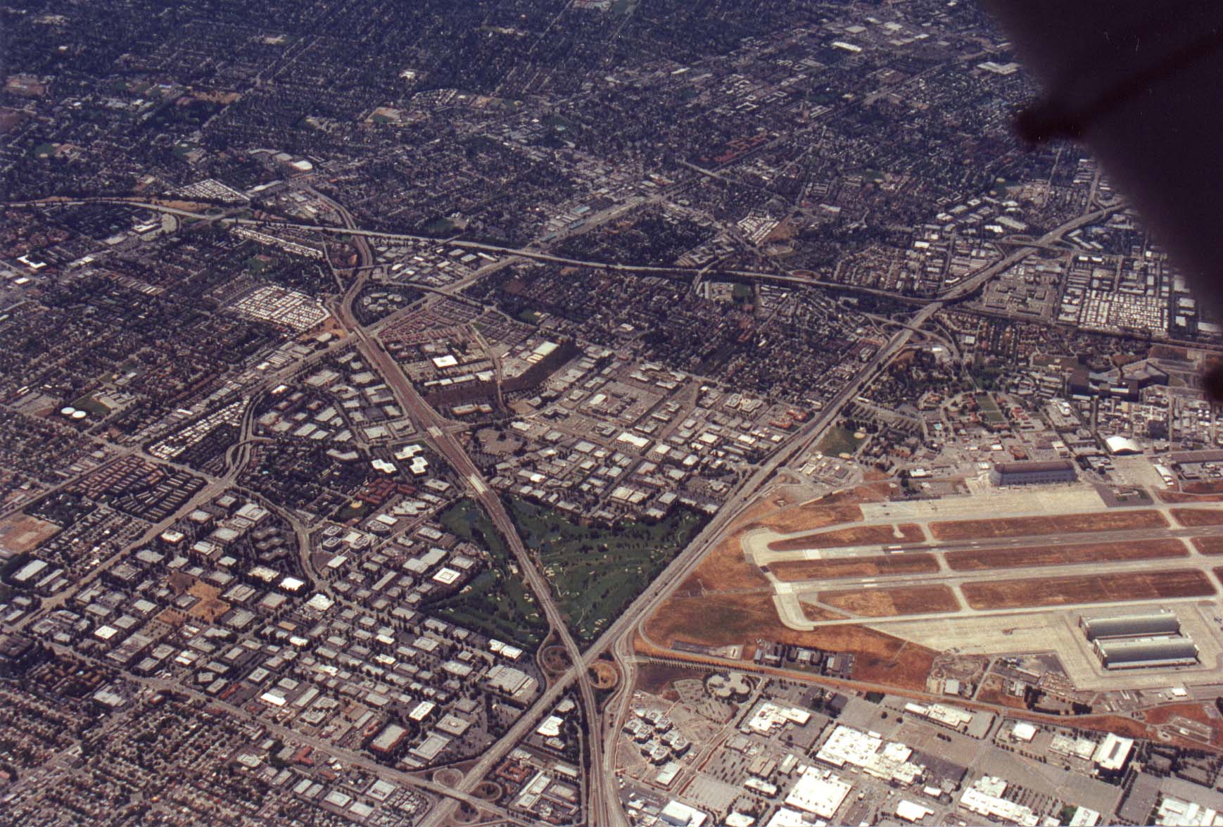
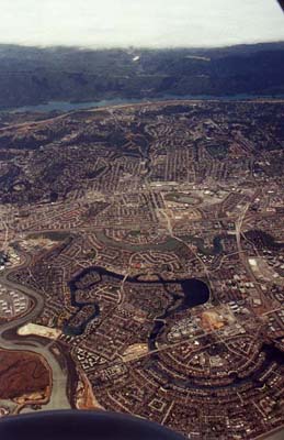
The triangle formed by Highway 85 on the
top, 237 on the left, and 101 oin the right. We're next to
Mountain View at this point. |
| Looking straight down at Moffett Field in Mountain
View. |
 |
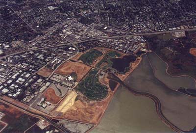 |
Shoreline park and Amphitheater, also in
Mountain View. |
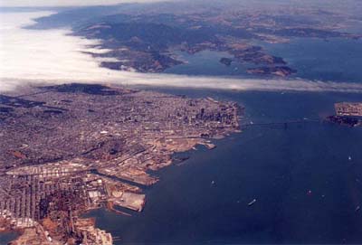
| A wide angle shot looking up the peninsula towards
San Francisco. Fog is piled up against the coast range as it
usually does in the summer months. |
 |
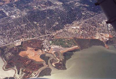 |
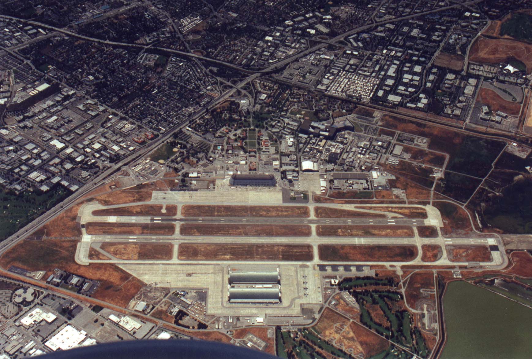
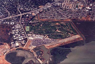
Palo Alto Airport, where this whole adventure
started and where it will end. |
| A closer view of Palo Alto Airport. |
 |
 |
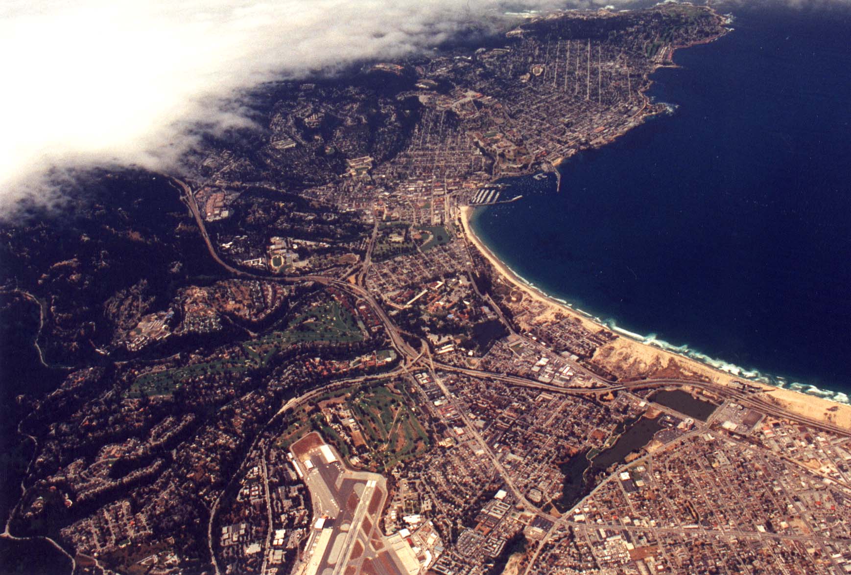
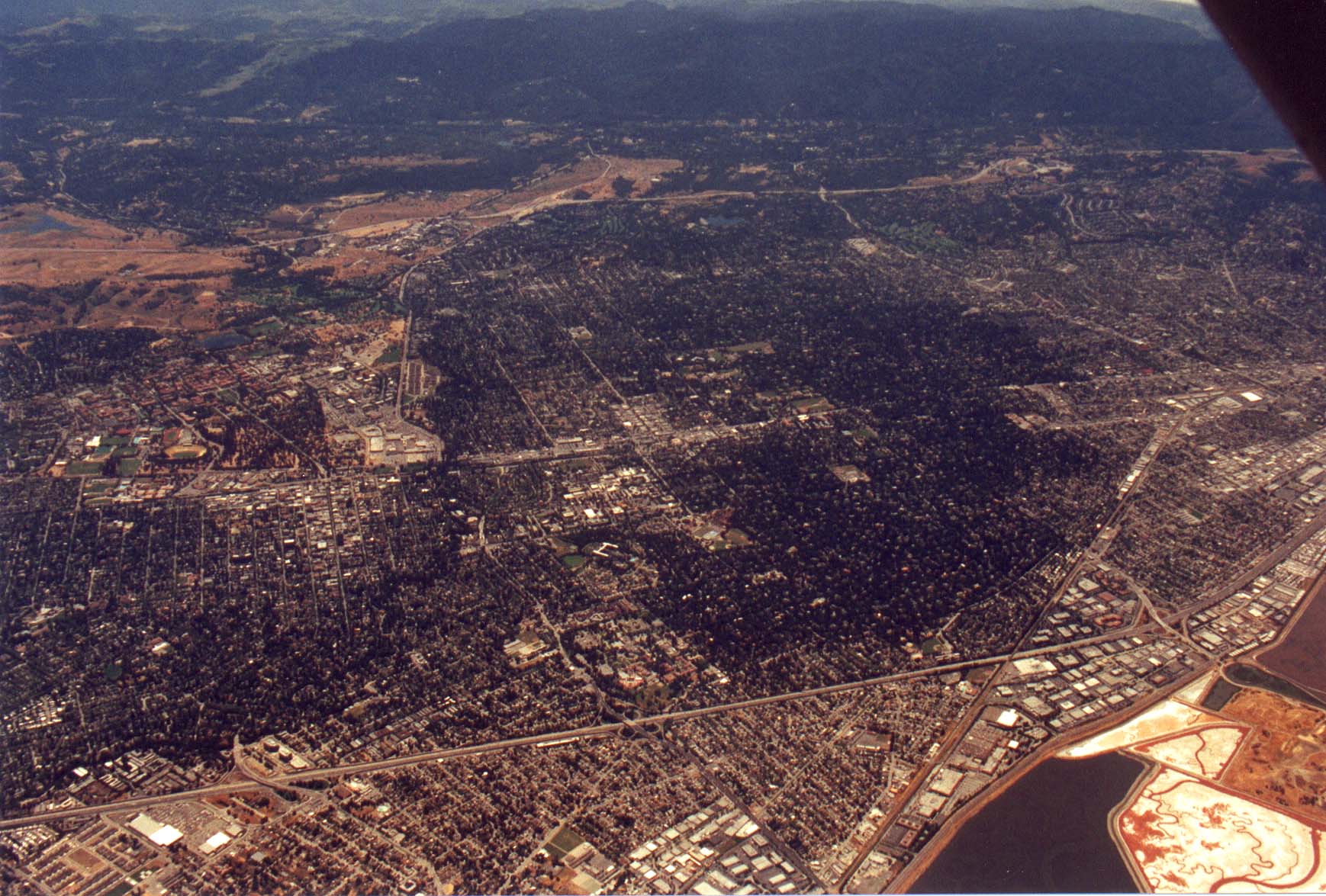
Palo Alto, Menlo Park, and Atherton. |
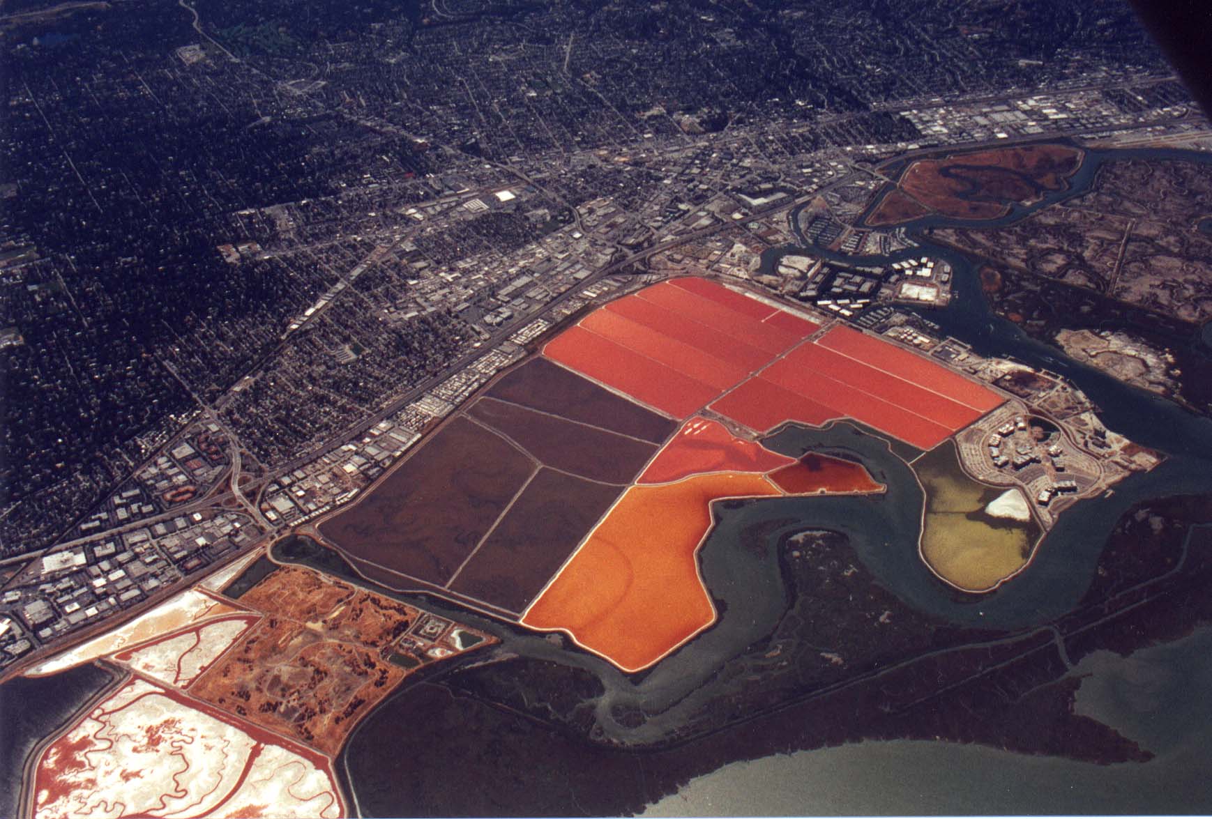
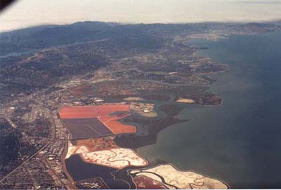
| Salt evaporation ponds south of San Carlos on the
Peninsula. |
 |
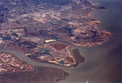 |
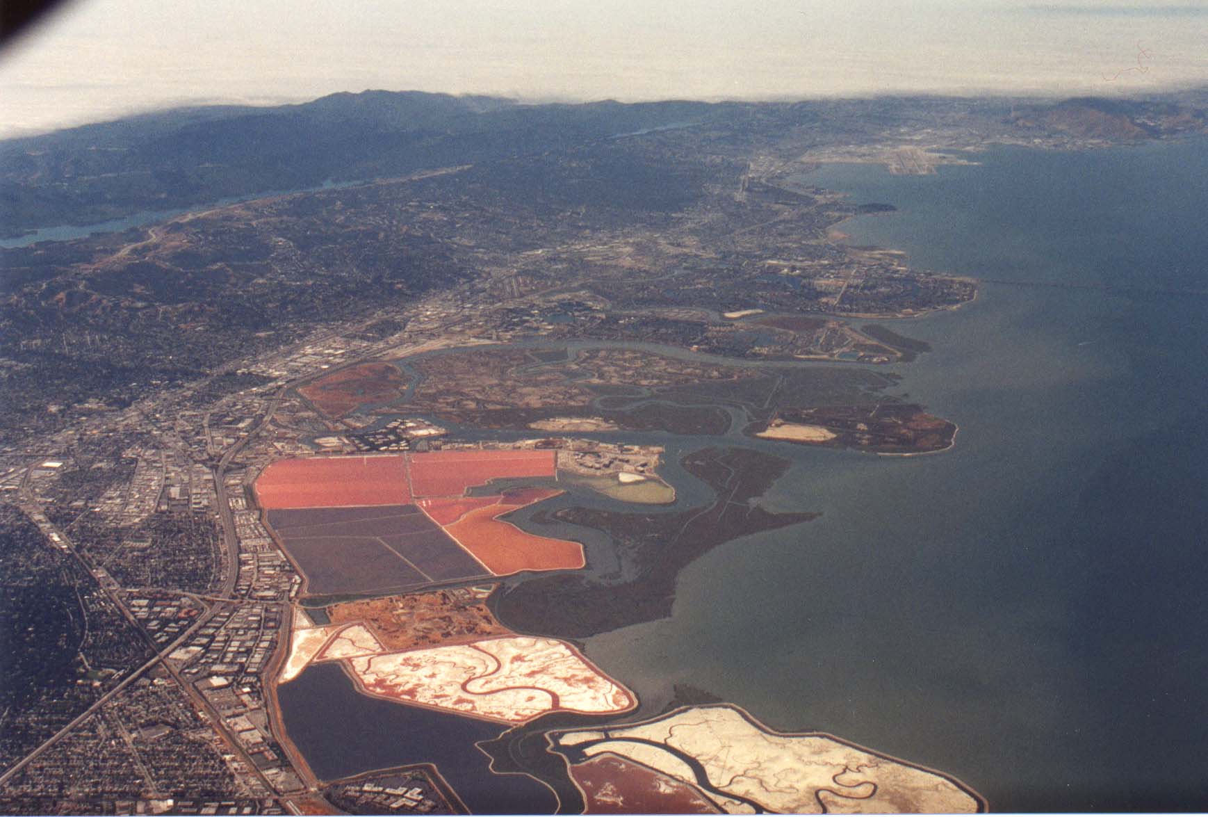
Approaching Foster City. |
| The width of the peninsula can be seen in this
picture. Foster city is in the foreground (along with the
landing gear :), Highway 101 and
El Camino are horizontal in about the center of the picture,
then 280 is near the top, then Crystal Springs resovoir (spelling?),
some hills and coastal fog. |
 |
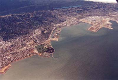 |
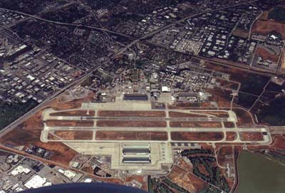
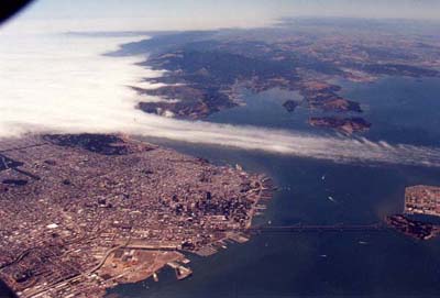
Looking north towards SFO, clearly visible in the top
right of this picture. |
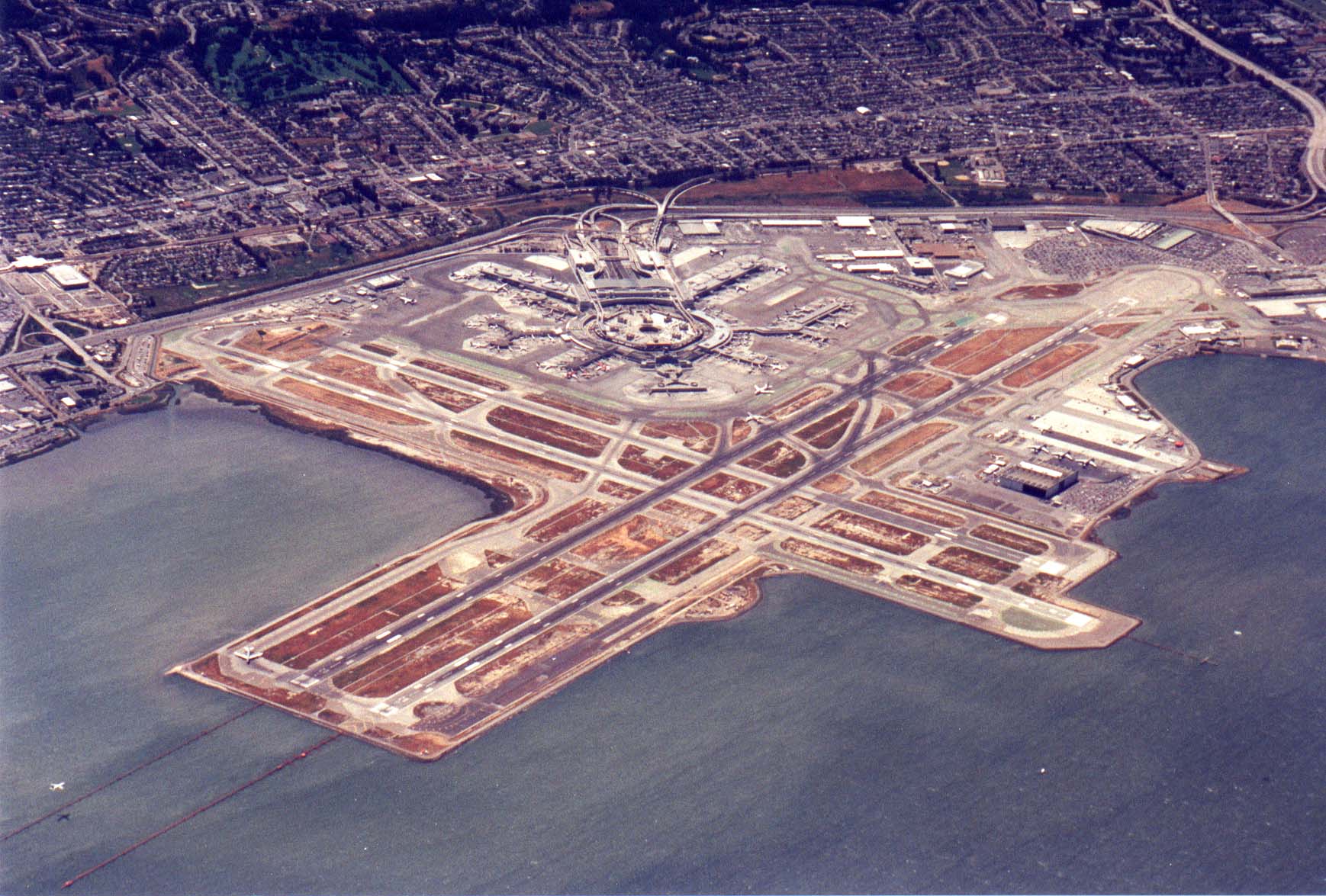
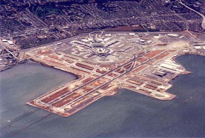
| San Francisco International Airport. You can see
a jet on final approach to one of the runways in the lower left
of the picture. |
 |
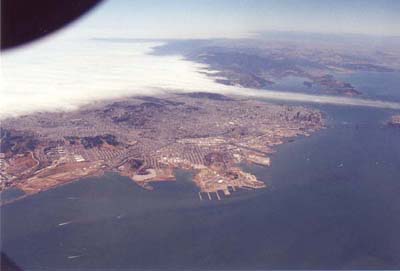 |
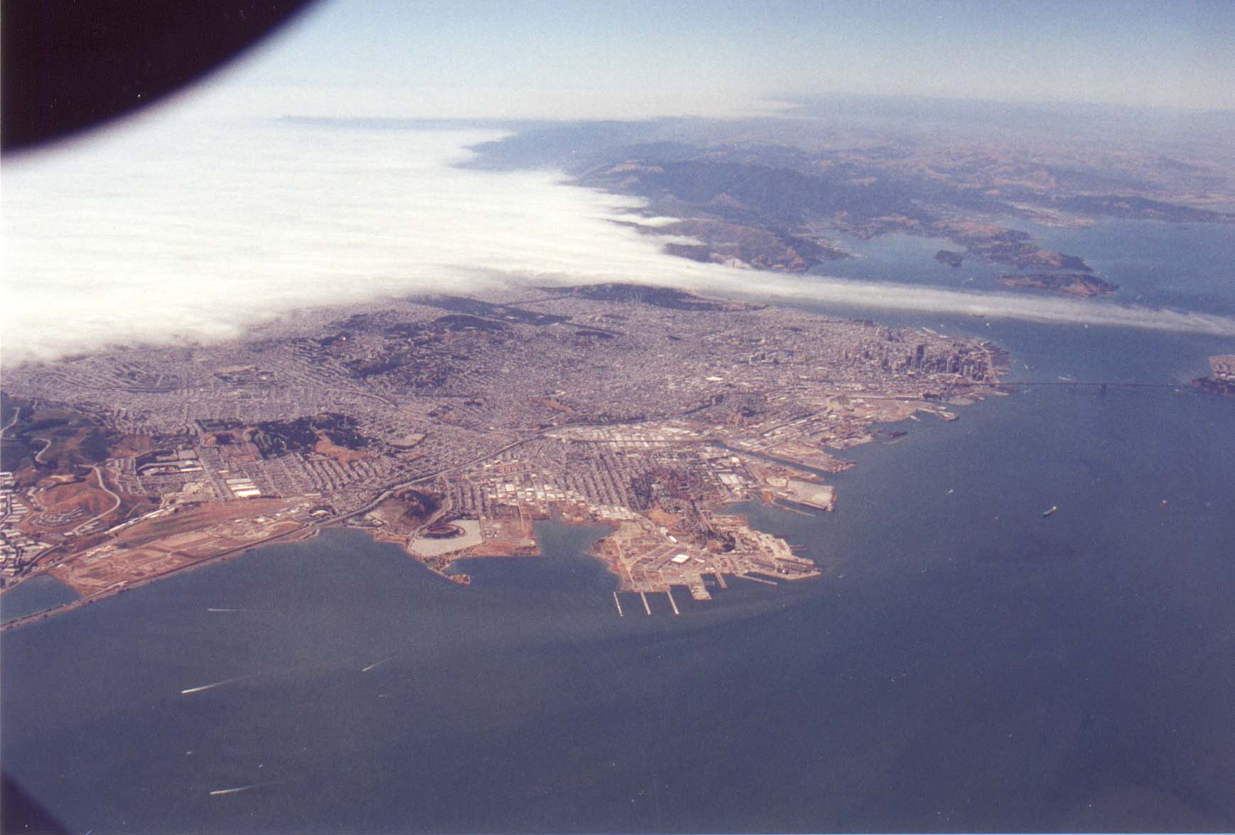
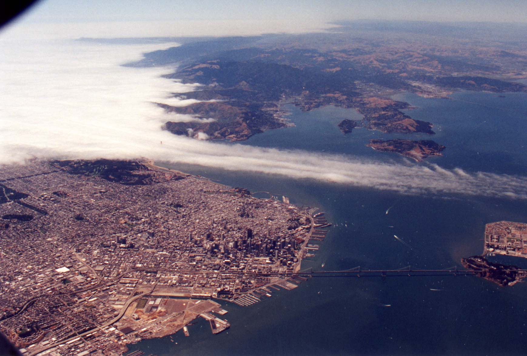
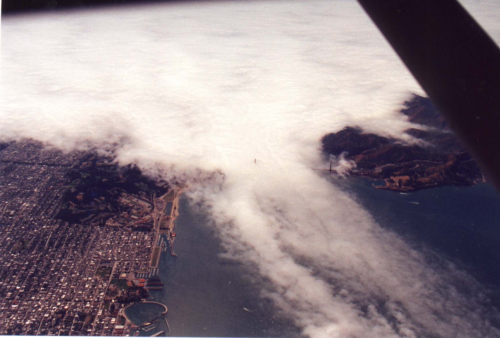
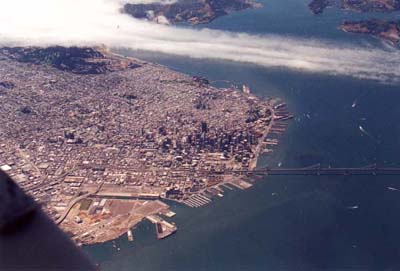
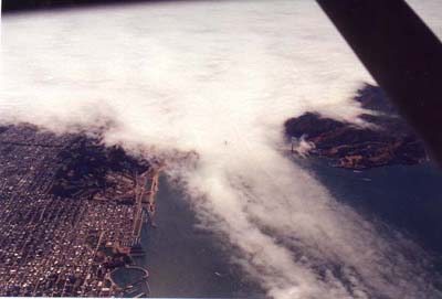
The tip of the peninsula, San Francisco. I think it's
very cool the way the fog rolls in over the Golden Gate Bridge
and straight across the bay without a single turn, diversion, or other
disturbance. |
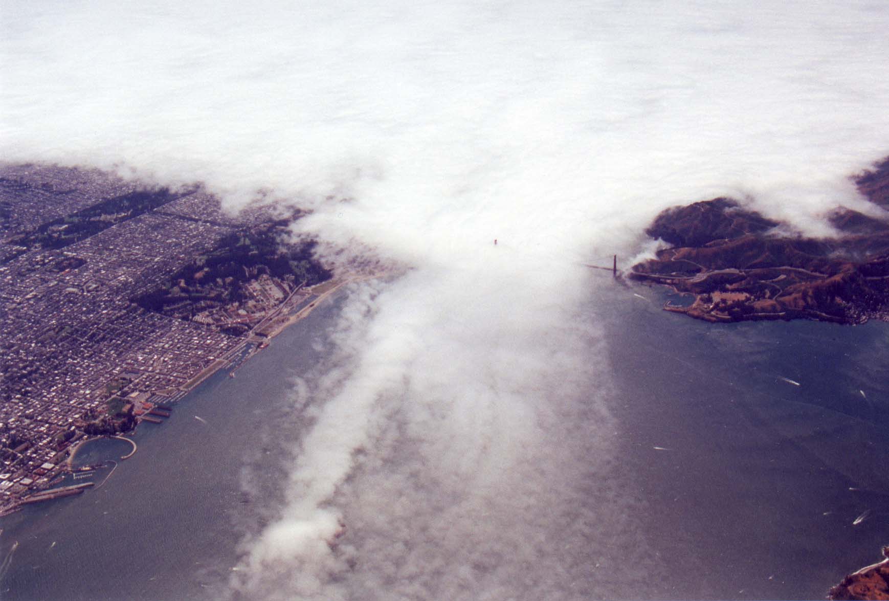
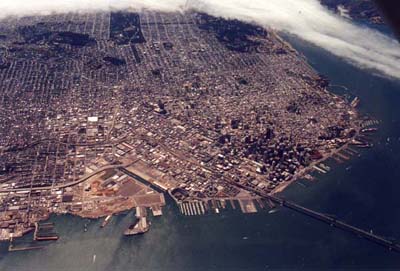
| A closer view from the same angle. Treasure Island
is in the right center of the picture. |
 |
 |
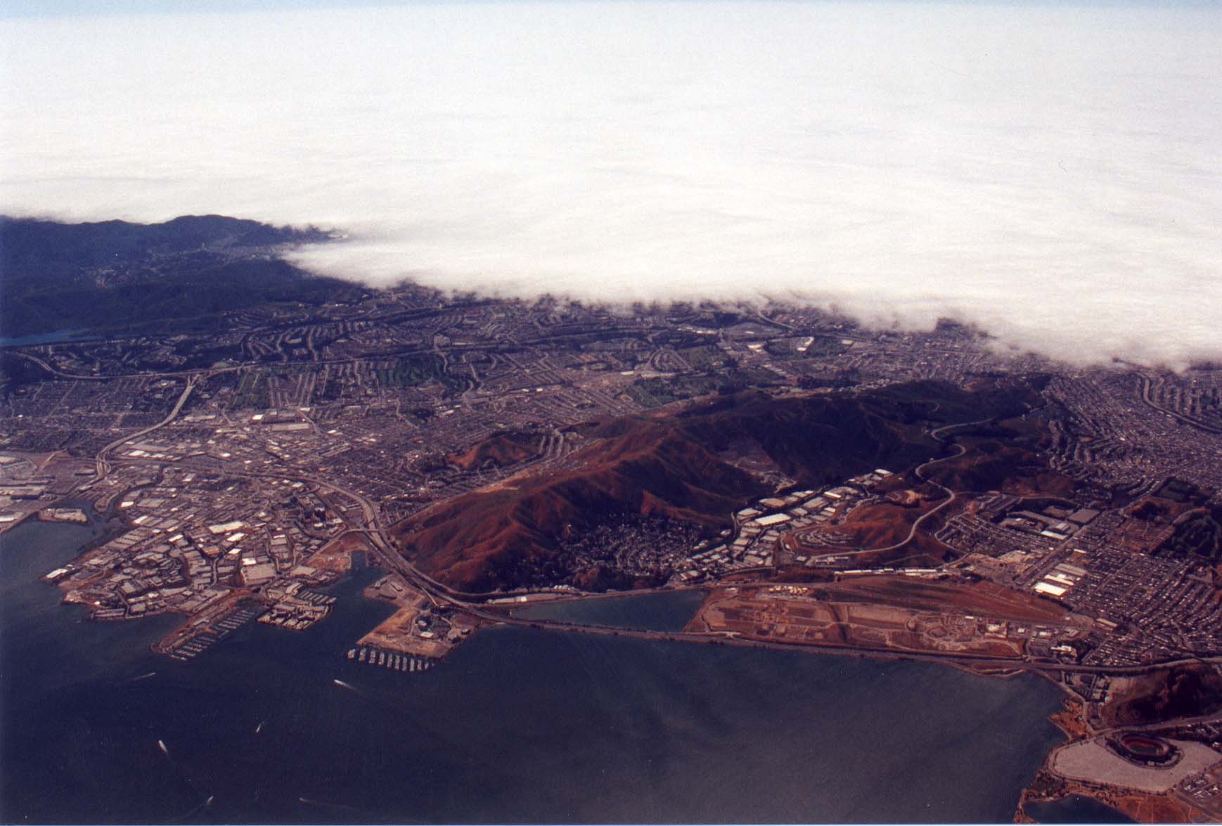
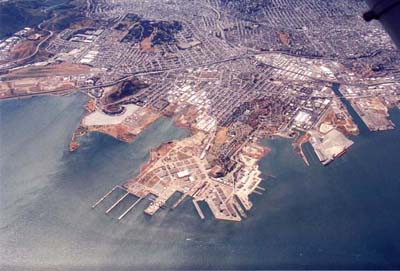
San Bruno Mountain, just north of SFO. 101 is
in the foreground, and Candlestick/3com park is in the lower
right of this shot. |
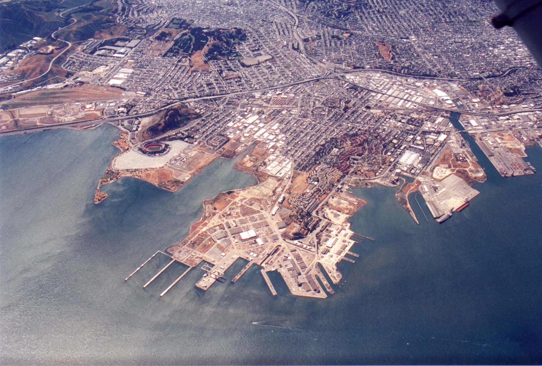
| A closer view of Candlestick/3com and the San Francisco
Harbor area. |
 |
 |
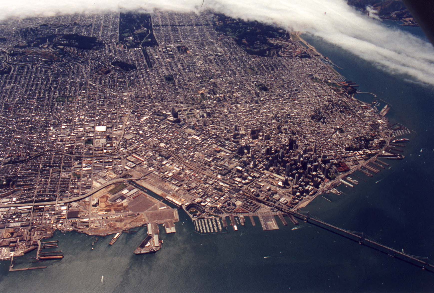
Getting closer to San Francisco. |
| And closer. |
 |
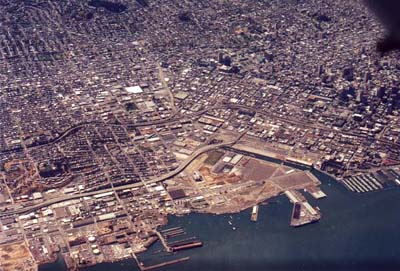 |
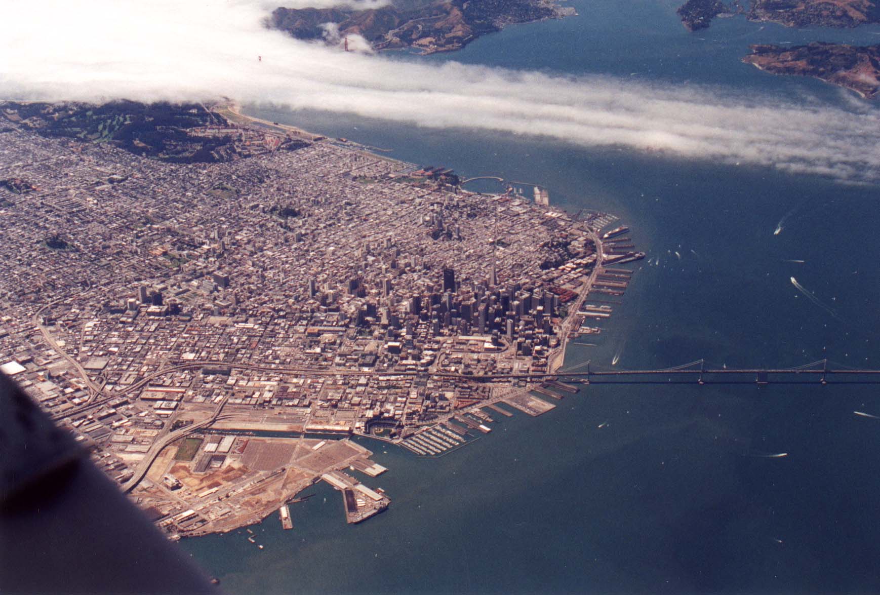
The south of Market area in San Francisco. 280 is
in the foreground and 101 is in about the middle of the picture.
PacBell park is visible in the lower right. |
| Just about over downtown. |
 |
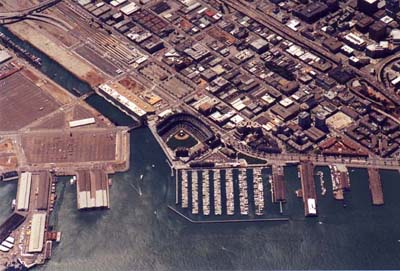 |
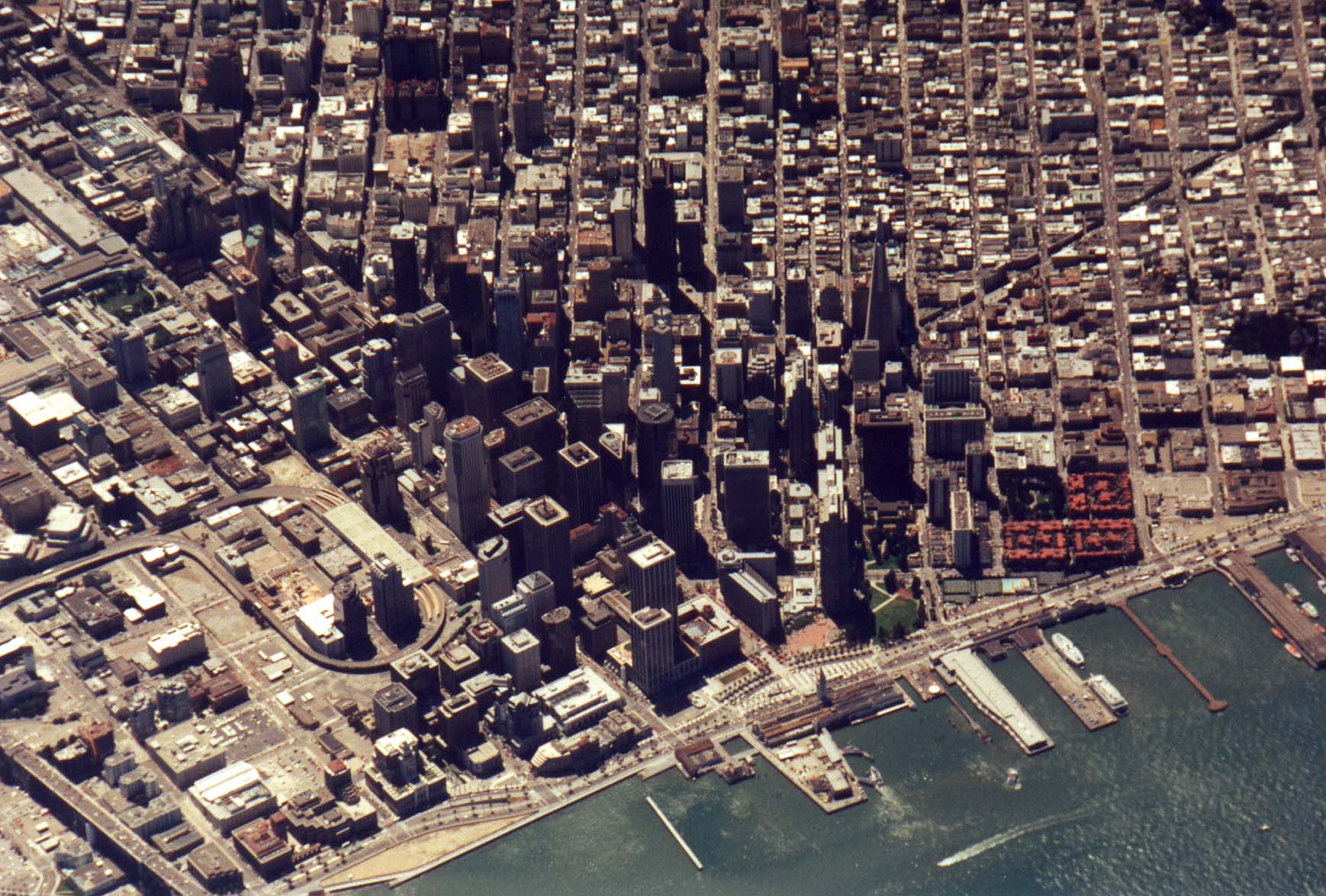
A close in shot of PacBell park and Covey cove. |
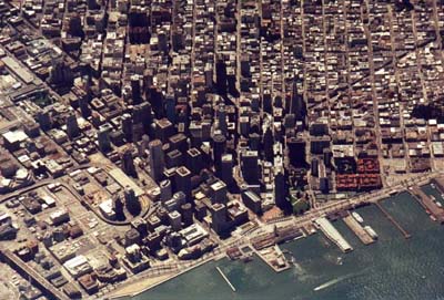
| A zoom in shot of downtown San Francisco.
The ferry building is at the end of Market, which is the
main street that goes diagonally through downtown, top left
to middle bottom in this picture. The approach to the Bay
Bridge is in the lower left. |
 |
 |
Fog flowing over the Golden Gate Bridge. |
| From a different angle. |
 |
And at this point I began a descent towards Concord. I considered this trip
more than successful, and saved the sights on the East Bay for another
day.
Back
All images copyright Rich Prillinger, 2005, 2006, 2007, 2008, 2009, 2010, 2011, 2012, 2013
Please ask for permission before use
web at richp d0t com